
Command the Controller. Dominate the Airspace.

Military-Grade Precision. Civilian Impact.
Aerial operations built on 20+ years of naval air traffic control experience - now deployed for your mission.

About THE FOUNDER
Corey isn’t just a drone pilot - he’s a commander of the sky.
An FAA certified Air Traffic Control Specialist. Retired U.S. Navy Air Traffic Control Specialist, he spent over 20 years orchestrating flight operations where failure wasn’t an option. His background? Real aircraft. Real missions. Real stakes.
Today, he brings that same high-stakes discipline to Eagle’s Nest, delivering unmanned aerial operations with tactical focus, veteran timing, and airspace dominance.
Whether you need advanced imaging, high-resolution mapping, or eyes in the sky for public safety—Eagle’s Nest delivers with command-grade reliability.

“Anyone can fly a drone. Few can control the airspace. That’s what I do.”
— Corey, Founder & Chief Operator
Professional Drone Services That Go Beyond Flight
At Eagle’s Nest Drone Services, we don’t just fly drones—we deliver precision-driven aerial solutions tailored to your mission.
Every operation is designed for accuracy, clarity, and tactical execution, ensuring exceptional results for your project. Explore our comprehensive range of services:
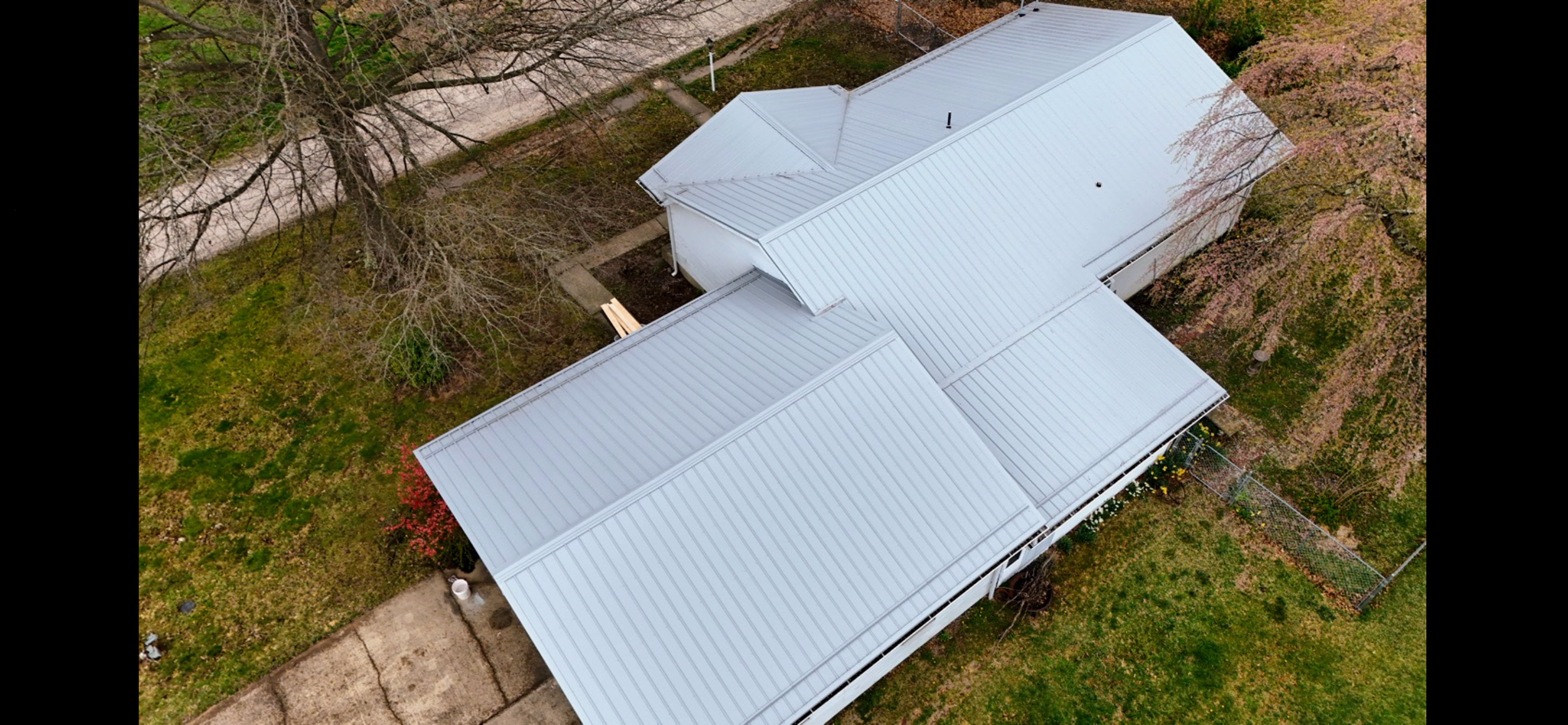
Aerial Photography & Cinematic Drone Videography
Capture stunning high-resolution aerial photos and 4K cinematic videos for real estate listings, marketing campaigns, and landscape showcases. Perfect for businesses looking to elevate visual storytelling.
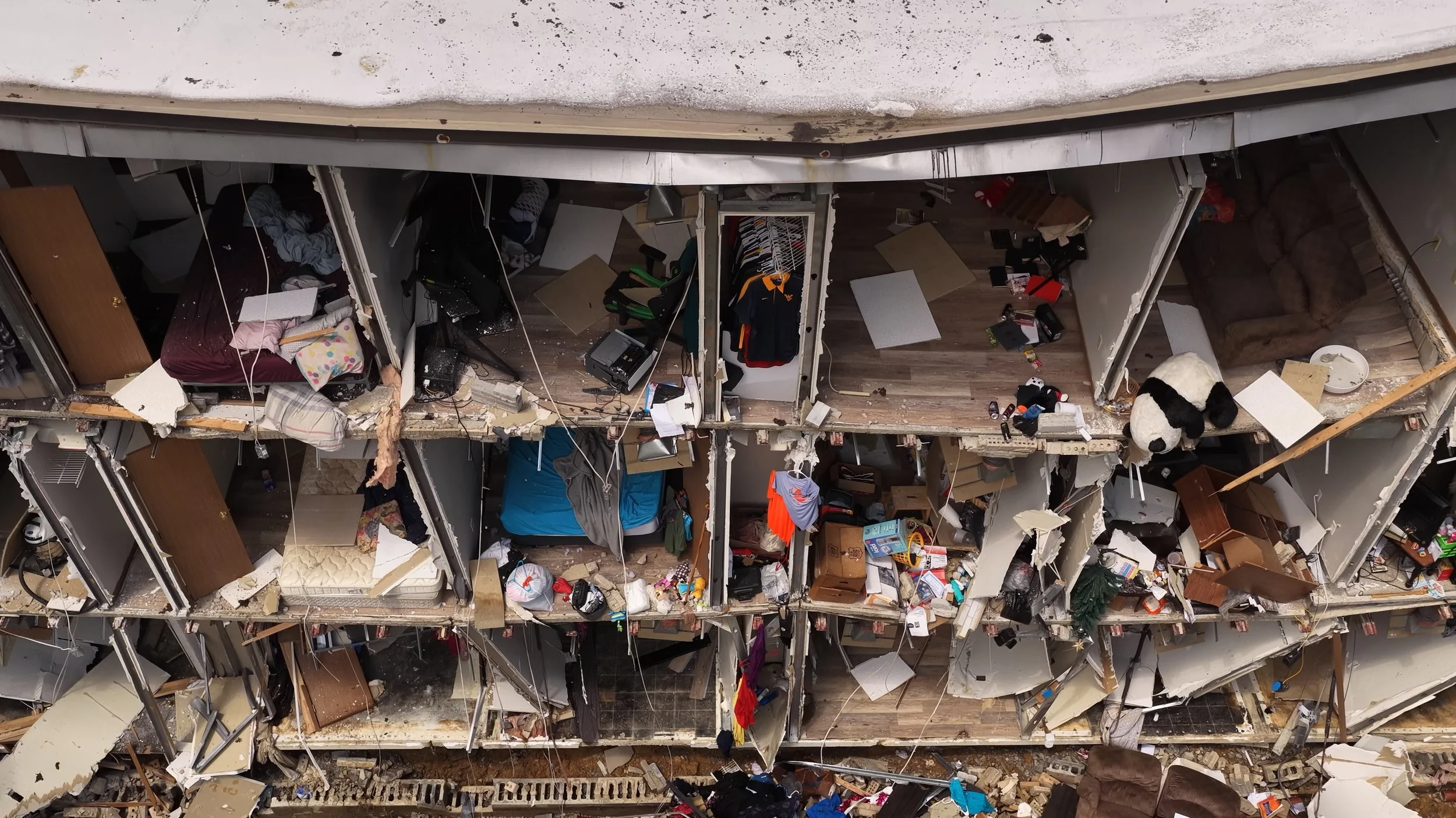
Thermal Imaging & Night Drone Operations
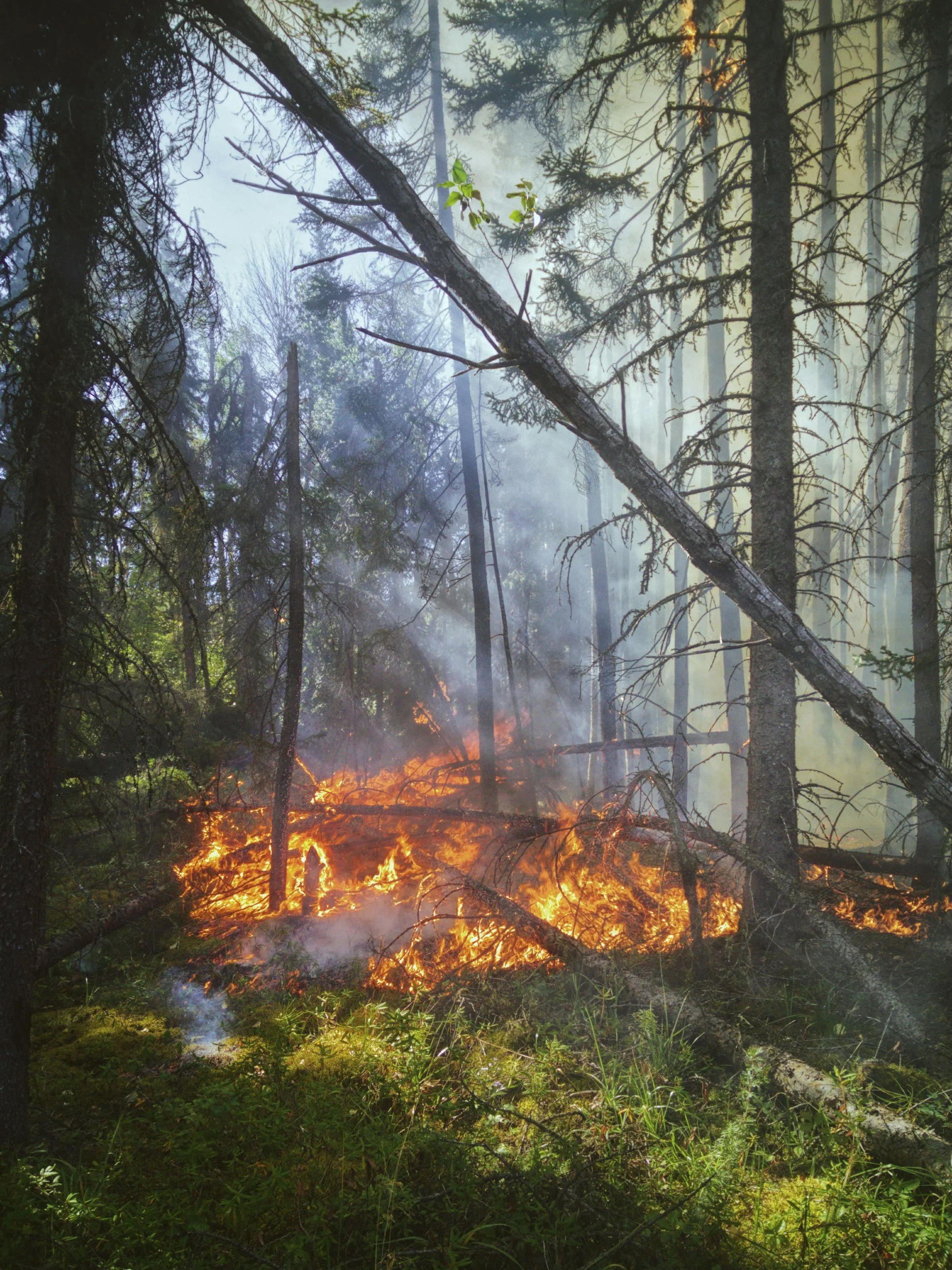
Enhance visibility in challenging conditions with thermal drone imaging and night flight capabilities. Ideal for search-and-rescue missions, law enforcement support, and critical infrastructure inspections.
Advanced Drone Surveying & Mapping
Leverage cutting-edge technology for orthomosaic mapping, 3D topographic models, and CAD-integrated mapping solutions. Our drone surveying services deliver accurate data for engineering, construction, and land development projects.
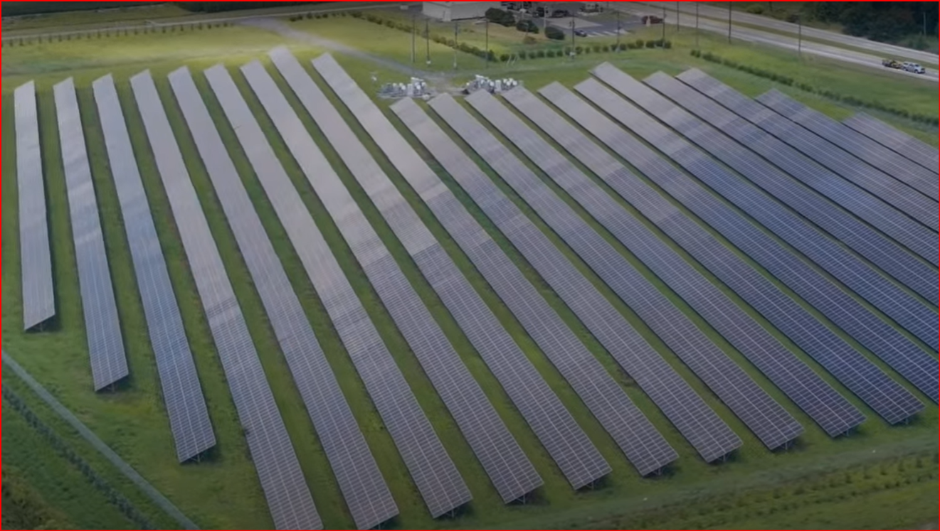
Agricultural Drone Monitoring & Crop Analysis
Optimize your farm operations with NDVI crop health scans, growth pattern tracking, and precision agriculture data. Our agricultural drone services help farmers make informed decisions for better yields.
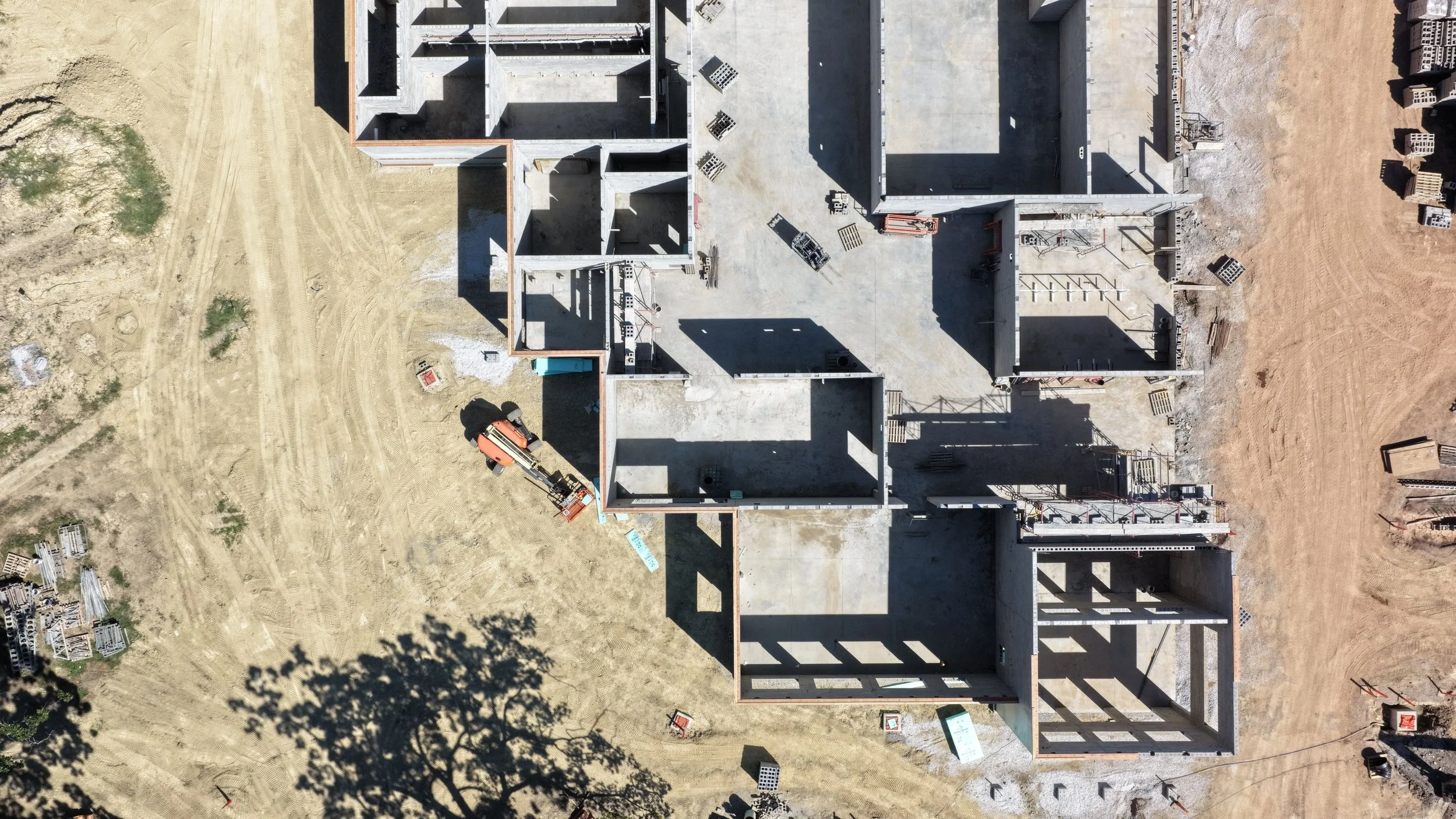
Construction Progress Tracking & Infrastructure Reports
Keep stakeholders aligned with drone construction monitoring and progress documentation. Our aerial reports provide a bird’s-eye view of your project, ensuring transparency and efficiency.
Custom Drone Flight Operations
Have a unique mission? We’ll design a custom drone flight plan tailored to your specific goals. From concept to execution, we deliver results that exceed expectations.
Why Choose Eagle’s Nest Drone Services?
FAA Part 107 Certified Pilots
High-Resolution Imaging & 4K Video
Advanced Mapping & Data Solutions
Reliable, Safe, and Professional Operations
Ready to elevate your project?
Contact us today for a free consultation and discover how our professional drone services can transform your vision into reality.
SERVICES
Industries We Serve – Expert Drone Solutions for Every Sector
Your terrain is our domain. At Eagle’s Nest Drone Services, we deliver precision aerial operations where it matters most. Explore the industries we support with advanced drone technology:
Law Enforcement & Emergency Response
Enhance public safety with thermal drone imaging, real-time overwatch support, and active scene documentation. Ideal for search-and-rescue missions, crime scene analysis, and disaster response.
Construction & Infrastructure
Streamline project management with drone construction monitoring, progress tracking, and risk identification. Our aerial insights help verify milestones and keep stakeholders informed—fast and accurately.
Agriculture & Land Management
Boost productivity with agricultural drone services including NDVI crop health analysis, growth monitoring, and precision mapping. Make informed decisions to optimize yield and reduce costs.
Environmental & Conservation Groups
Survey forests, waterways, and ecosystems with minimal ground disturbance. Our drones provide high-resolution environmental mapping for conservation projects and habitat assessments.
Municipal & Government Contracts
Support urban development with drone mapping for city planning, road infrastructure analysis, and public works documentation. We deliver accurate data for smarter decisions.
Private Clients & Creative Projects
From luxury estate aerial photography to cinematic brand visuals and special event coverage, our custom drone missions bring your vision to life with stunning perspectives.
Why Partner With Eagle’s Nest Drone Services?
FAA Part 107 Certified Pilots
Advanced Drone Technology
High-Resolution Imaging & Data
Custom Solutions for Every Industry
Ready to elevate your operations?
Contact us today for a free consultation and discover how our professional drone services can transform your industry.

Equipment & Tech Stack
We don’t cut corners—we fly elite, industry-leading gear to deliver precision and performance on every mission.
Our Fleet
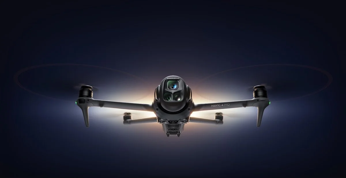
DJI Mavic 4 Pro – Exceptional stability and 4K imaging for professional-grade aerial photography.
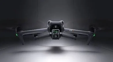
DJI Air 3 – Versatile and reliable for dynamic shoots and mapping projects.
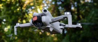
DJI Avata 2 – Agile FPV drone for immersive fly-throughs and cinematic experiences.
Additional Specialized Drones – Tailored for unique missions and advanced applications.
CERTIFICATIONS & CREDENTIALS
FAA Part 107 Certified
FAA Air Traffic Control Specialist
Licensed & Insured
Recreational UAS Safety Test (TRUST) Certified
-Documents available upon request

REQUEST A MISSION
You don’t need a quote. You need results.
Use the form below to describe your objective. We’ll review your mission profile, recommend the optimal flight package, and confirm airspace clearance.
COMMUNITY SUPPORT & DONATIONS
Elevate More Than Just Data.
Eagle’s Nest is committed to community-first operations - especially in supporting emergency response, youth mentorship, and veteran-led outreach. When you support our platform, you’re investing in:
•Search-and-rescue readiness drills
•Veteran training programs in drone tech
•Mentorship flights for underserved youth
Support the mission. Donate below.
LATEST UPDATES / NEWS
LATEST UPDATES / NEWS
Waterside District in Downtown Norfolk offers premier dining, entertainment, and nightlife on the waterfront. This dynamic space hosts live performances, festivals, and sports-watching, appealing to both locals and visitors.
Stay in the Loop.
From emergency deployments to new gear integrations, Eagle’s Nest is always evolving. Check here for our latest missions, footage, and community updates.